A laser that times its own echo, a sensor that supplies its own light, and a self-driving industry that still has to prove its software can cope with the real world.
Lidar fires laser pulses and times their reflections to measure distance, building a 3D picture with its own illumination. Self-driving cars use lidar and cameras together, often with radar. As of late 2025 no system has achieved full autonomy in all domains, and software remains the main obstacle.
When the small helicopter Ingenuity made its record-setting flights over the surface of Mars, it found its way over the terrain with lidar, the same family of laser ranging that is now used in the control and navigation of autonomous cars. A technology that began as a way to track satellites now helps a robot fly on another planet, and it sits at the centre of one of the car industry's most argued questions.
What is lidar?
The name abbreviates light detection and ranging, and some write it out as laser imaging, detection and ranging. A lidar unit points a laser at an object or surface and times how long the reflected light takes to come back to its receiver. Because light travels at a known speed, that delay gives the distance: multiply the speed of light by the round-trip time and halve the answer.
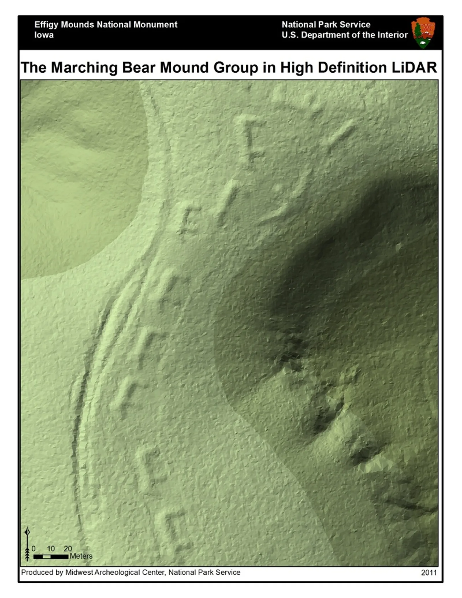
Some units look in a fixed direction. Others scan, combining 3D scanning with laser scanning to build up a picture. The technique is used around the world for high-resolution maps, in surveying, archaeology, forestry and atmospheric research, and increasingly in control and navigation for autonomous cars. NASA has identified it as a key technology for letting future robotic and crewed lunar landers touch down safely and precisely.
Lidar supplies its own light, sends out a pulse and times the echo, so it does not wait for the world to be lit.
How does a lidar sensor see?
It uses ultraviolet, visible or near-infrared light, and a narrow beam can map physical features at very high resolution. Flown on an aircraft, a beam can resolve terrain down to 30-centimetre (12 in) detail or finer. The light is returned by backscattering rather than by a clean reflection like the one from a mirror, and it can pick out an extraordinary variety of targets, from non-metallic objects and rocks to rain, clouds and even single molecules.
The crucial point for a car is that lidar is an active sensor. It supplies its own illumination, sends out a pulse and records the time between the pulse leaving and the backscatter returning. It does not wait for a scene to be lit by something else.
Engineers have a choice of designs. Direct detection measures changes in the amplitude of the returned light. Coherent detection is better at measuring Doppler shifts or changes in phase, and it is more sensitive, so it can run at much lower power, though it needs more complex transceivers. Micropulse systems fire intermittent bursts using around one microjoule in the laser and are often rated eye-safe, so no special precautions are needed.
Which wavelengths do lasers use?
Lasers of 600-1,000 nm are the most common for non-scientific work, and their power is limited to keep them safe for eyes. One alternative is 1,550 nm. Water absorbs this wavelength strongly, so very little reaches the retina and it stays eye-safe at relatively high power, although camera sensors can still be damaged. The trade-off is that detector technology at that wavelength is less advanced, so it tends to be used at longer ranges with lower accuracy. Night vision goggles cannot see it, whereas they can see the shorter 1,000 nm infrared.
How does it scan a whole scene?
Aiming one laser at one point is easy. Building a three-dimensional picture of a road means aiming it everywhere, quickly, and the way that is done shapes the cost and toughness of the sensor.
| Approach | How it works | Strength | Weakness |
|---|---|---|---|
| Oscillating or polygon mirrors | Mirrors sweep the beam in azimuth and elevation | Established; scan speed sets image speed | Moving parts |
| MEMS mirror | One tiny mirror reorients a single laser | Small and cheap | Works in one plane; needs a second mirror or laser; can be disrupted by shock and vibration |
| Phased array | Controls the phase of a huge number of optical antennas | No moving parts, as in radar since the 1940s | Very difficult, if possible at all, in lidar |
| Flash lidar | Emits a wide flash and senses the return across the whole scene | No stitching of frames; not sensitive to platform motion; less distortion | Needs detector arrays |
The phased array is the hardest. Producing a pattern of a given size would need something like a million optical antennas, each controlled in phase with great precision, all coherent and each roughly the wavelength of the light in size, about one micron.
Detector chips offer another route. Lincoln Laboratory announced a chip in 2014 with over 16,384 pixels, every one capable of imaging a single photon, which let it capture a wide area in a single frame. An earlier generation with one fourth as many pixels was sent by the US military after the January 2010 earthquake in Haiti. One pass of a business jet flying at 3,000 m (10,000 ft) above Port-au-Prince took snapshots, each covering a 600 m (2,000 ft) square, with 30 cm (1 ft) detail that revealed how high the rubble lay in the streets. The 2014 chip was ten times better. It uses indium gallium arsenide, which works in the infrared at a relatively long wavelength, allowing higher power and longer ranges, and in applications such as self-driving cars it would lower costs by removing the need for a mechanical component to aim it.
How is lidar different from radar and cameras?
Radar uses radio waves to find distance, direction and radial velocity. Lidar is a close relative that relies on light, predominantly infrared from lasers, instead of radio waves. The name itself began as a portmanteau of light and radar. Radar has deep roots: in 1904 Christian Hulsmeyer demonstrated that radio waves could detect a ship in dense fog, and today's systems rely on digital signal processing and machine learning to extract useful information from very noisy returns.
In cars, automotive radar already handles adaptive cruise control and emergency braking. It ignores stationary roadside objects that could cause a wrong brake application and measures moving objects instead, to prevent collisions with other vehicles. With the arrival of driverless vehicles, radar is expected to help the automated platform monitor its environment.
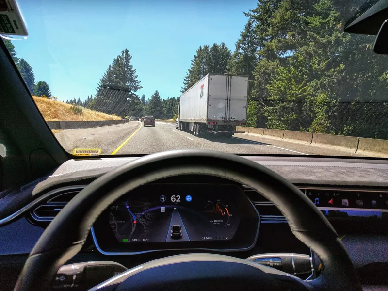
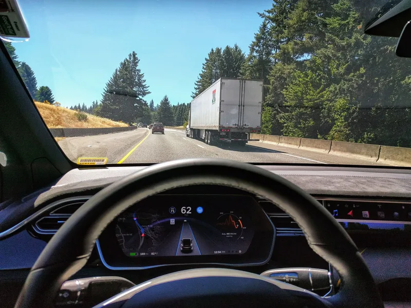
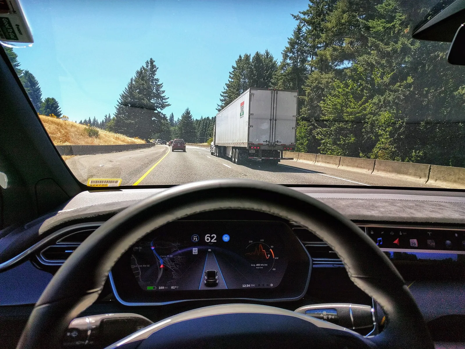
Cameras, the third sensor, capture images and video in the way human eyes do. Two technologies are now used primarily in self-driving cars: lidar and these visual sensors. They are combined with GPS, neural networks, artificial intelligence and established driver-assistance engineering to deliver the different levels of autonomy.
Where does the real obstacle lie?
Not in the sensors. The chief hurdle for self-driving is software and mapping sophisticated enough to stay safe across the huge range of conditions drivers meet. The software cannot yet handle every circumstance, and it has been involved in accidents and deaths. Further problems include protecting over-the-air updates, legal and regulatory questions, ethics and consumer confidence.
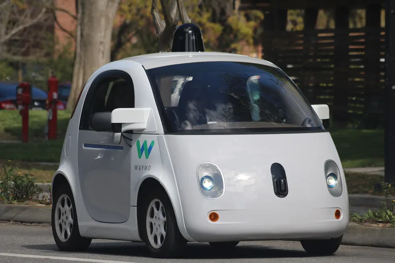
In 2020 Waymo became the first to sell rides in driverless taxis, inside limited geographic areas called operational design domains. By late 2025 nothing had reached full autonomy across every domain, which SAE International calls Level 5 on its scale of 0 to 5.
The makers have taken different roads. Tesla lets its Full Self-Driving system be used in all operational design domains but as a Level 2 driver-assistance system, with hands on and eyes on. Waymo picked particular domains for its robotaxi service: city streets in Phoenix and San Francisco. Mercedes-Benz sold Level 3 for highway traffic jams, with a ceiling of 40 miles per hour (64 km/h), then withdrew it in January 2026 and said a Level 2 capability was coming. Mobileye's SuperVision allows hands-off driving with eyes on the road to 130 km/h (81 mph). GM's Super Cruise is confined to chosen roads, and Ford's BlueCruise runs on US divided highways totalling 130,000 miles (210,000 km).
What do the levels mean?
SAE International's J3016 standard, first published in 2014, defines six levels, from fully manual to fully automated. The United Nations Economic Commission for Europe adopted it as UN Regulation No. 157, which took effect in January 2021 and applies in more than 50 countries. The levels turn on the role of the driver, and a car can move between them. It might hold Level 3 for lane management up to 100 km/h but fall back to Level 2 above that speed.
Level 1 covers adaptive cruise control, emergency brake assist and lane-keeping. Level 2 includes highway assist, automatic parking and autonomous obstacle avoidance. From Level 3 upwards, the system must recognise when it is leaving its operational design domain, for example when a clear highway becomes a construction zone, and fall back by asking the driver to intervene if necessary.
What should a driver make of the names?
The marketing is less clear than the standard. Labels such as DrivePilot, Full-Self Driving, PilotAssist and AutonoDrive are in use, yet the products bundle assorted features that may not live up to the label, and Tesla itself stated that its system does not autonomously handle all driving tasks. The Association of British Insurers called the word autonomous in advertising dangerous, because it leads motorists to think the car can control itself when it cannot.
Public trust is thin. In a 2022 survey, just 27% of respondents worldwide said they would feel safe riding in a self-driving car. There is also what researchers call self-AV bias, in which drivers judge identical driving much more harshly when an autonomous vehicle does it than when a human does.
Where did lidar come from?
E. H. Synge conceived the essential concept in 1930, envisaging powerful searchlights probing the atmosphere. Under Malcolm Stitch, Hughes Aircraft brought out the earliest lidar-like system in 1961, soon after the laser was invented, for tracking satellites. It was first called Colidar, for coherent light detecting and ranging. Then in 1963 the Colidar Mark II arrived, a bulky rifle-style rangefinder for military targeting that reached 11 km with an accuracy of 4.5 m.
Early civilian use was in meteorology, where the National Center for Atmospheric Research measured clouds and pollution. The public learned how accurate lidar could be in 1971, when a laser altimeter on Apollo 15 let astronauts chart the Moon's surface.
Where this goes next
Detector arrays are the area to watch. Technologies for infrared single-photon counting lidar, including arrays and cameras in various semiconductor and superconducting platforms, are advancing rapidly. Chips of the kind announced in 2014 are described as a way to lower the cost of self-driving cars by removing the mechanical aiming part.
On the road, GM announced in 2024 that it planned to widen Super Cruise coverage from 400,000 to 750,000 miles of road (1,210,000 km), and Mercedes-Benz has pointed to a coming Level 2 capability in place of its Level 3 feature.